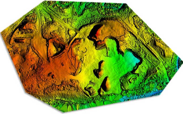
 Creating digital maps has become easier and more efficient with the use of UAVs. We are able to collect data of an Area-of-Interest (AOI) using LiDAR and photogrammetry, and process such data to generate point cloud and digital terrain models. Compared to traditional surveys, it is significantly easier and cheaper to collect data using UAVs and the results are much richer in detail.
Drones are becoming an integral tool in mining and surveys, replacing manual inspections in the most hazardous areas and collecting critical information, while drastically reducing the risk, time and manpower required.
Data results attainable using our drones can be used to create :
- Orthophotos
- Volumetric Surveys
- 3D Models
- DEM / DTM / DSM (surface models)
- Contour Maps